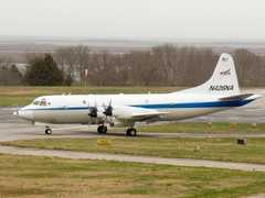
The Tail Doppler Radar (TDR) is an airborne, vertically scanning, pulse-Doppler X-band radar operated by NOAA. It is installed on the tail of the research aircraft and is typically equipped on NOAA’s P-3 aircraft for hurricane and precipitation research missions. TDR measures radar reflectivity and Doppler wind velocities in the 9315 MHz frequency band. It has a horizontal beam width of 1.35 degrees and a range gate spacing of 150 or 300 meters.

Instrument Details
- Radar
- Earth Science > Spectral/engineering > Radar > Radial Velocity > Mean Radial VelocityEarth Science > Spectral/engineering > Radar > Radar ImageryEarth Science > Spectral/engineering > Radar > Return PowerEarth Science > Spectral/engineering > Radar > Radial VelocityEarth Science > Spectral/engineering > Radar > Radar Reflectivity
- Full Column Profile
- Variable
- 150 m, 300 m
- 9315 MHz
- https://doi.org/10.1175/1520-0450(1983)022%3C0744:FTOAAP%3E2.0.CO;2
David Jorgensen
David Jorgensen
NOAA, NCAR
NOAA, NCAR
data center outside NASA
Filter data products from this instrument by specific campaigns, platforms, or formats.
CAMPAIGNS
PLATFORMS


