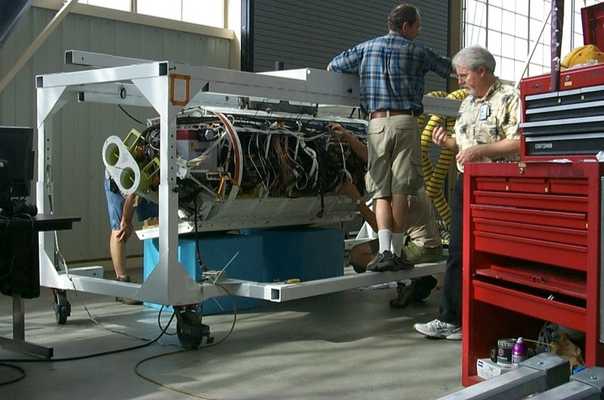
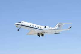
The Uninhabited Aerial Vehicle Synthetic Aperture Radar (UAVSAR) is an airborne polarimetric L-band radar developed and operated by the Jet Propulsion Laboratory (JPL). It provides differential interferometric measurements that help characterize deformation caused by phenomena such as earthquakes, volcanic activity, and glacial motion. UAVSAR operates at 1.26 GHz with a range bandwidth of 80 MHz. It offers a horizontal resolution of 6 meters and a swath width of 20 kilometers at an altitude of 12 kilometers.


Instrument Details
- Radar
- Earth Science > Spectral/engineering > Radar > Radar ImageryEarth Science > Spectral/engineering > Radar > Radar Backscatter
- Land Surface
- Variable
- 6 m
- 1.26 GHz
- https://doi.org/10.1109/TGRS.2014.2377637
Yunling Lou
Yunling Lou
JPL
NASA Instrument Incubator Program
 Gulfstream III 19 Campaigns · 14 Instruments | AfriSAR AfriSAR 2015—2016 Gabon tropical forests 1 Deployment · 10 Data Products
 SnowEx 2016—2023 Colorado, Idaho, Utah, Alaska 4 Deployments · 86 Data Products
 Arctic-Boreal Vulnerability Experiment 2017—2026 Alaska, Northwestern Canada Ongoing 6 Deployments · 130 Data Products
 Delta Exchange 2021—2023 Atchafalaya and Terrebonne basins of the Mississippi River Delta 2 Deployments · 68 Data Products
SMAPVEX Soil Moisture Active Passive Validation Experiment 2008—2022 United States, Canada, Iowa, Maryland, Arizona, Massachusetts, Manitoba 5 Deployments · 25 Data Products
 FireSense 2023—2027 Western United States, Southeastern United States, California, Montana, Arizona, Utah, Colorado, Alabama, Florida, Georgia, Mississippi, Texas, Oklahoma Ongoing 3 Deployments · 1 Data Product
UAVSAR AM-PM NISAR UAVSAR AM-PM Campaign 2019 Southeastern United States 1 Deployment · 0 Data Products
CanEx Canadian Experiment for Soil Moisture 2010 Saskatchewan, Canada 2 Deployments · 0 Data Products
|
Filter data products from this instrument by specific campaigns, platforms, or formats.