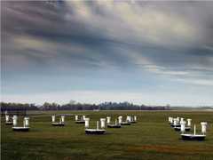
The USFS Scanning Lidar is a ground-based lidar system operated by the United States Forest Service (USFS). It measures vertically resolved backscatter to determine aerosol and cloud optical properties. It operates at three wavelengths: 355, 532, and 1064 nm. It averages 1800 pulses per 30 minutes and has an operational range of 1 to 20 km. Its primary purpose is to monitor the atmospheric properties of smoke plumes.

Instrument Details
- Lidar
- Earth Science > Spectral/engineering > Lidar > Lidar BackscatterEarth Science > Atmosphere > Aerosols > Aerosol BackscatterEarth Science > Atmosphere > AerosolsEarth Science > Spectral/engineering > Lidar
- Full Column Profile
- 30 min
- N/A
- 844.5 THz, 563.5 THz, 281.8 THz
- Currently unavailable
Vladimir Kovalev
Vladimir Kovalev
Currently unavailable
Currently unavailable
Currently unavailable
Unpublished
 Field Site Stationary 76 Campaigns · 175 Instruments | CalNex California Research at the Nexus of Air Quality and Climate Change 2010 California 1 Deployment · 0 Data Products
|