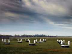
The Volume Imaging Lidar (VIL) is a ground-based lidar system operated by the University of Wisconsin. It is an elastic backscatter lidar operating at 1064 nm. It provides aerosol backscatter profiles with a range resolution of 7.5 m or 15 m. VIL has a maximum range of 18 km and a repetition rate of 30 Hz. The Naval Research Laboratory (NRL) also operates a VIL with similar specifications.

Instrument Details
- Lidar
- Earth Science > Spectral/engineering > Lidar > Lidar BackscatterEarth Science > Spectral/engineering > LidarEarth Science > Atmosphere > AerosolsEarth Science > Atmosphere > Altitude > Planetary Boundary Layer HeightEarth Science > Atmosphere > Aerosols > Aerosol Backscatter
- Full Column Profile
- 30 Hz
- 7.5 m, 15 m
- 281.7 THz
- Currently unavailable
Edwin Eloranta
George Vassiliou, Edwin Eloranta
University of Wisconsin, NRL
Currently unavailable
Currently unavailable
 Field Site Stationary 76 Campaigns · 175 Instruments |  WINter EXperiment 1999 Upper Midwest, Great Lakes, Canada 1 Deployment · 0 Data Products
 First International Satellite Land Surface Climatology Project (ISLSCP) Field Experiment 1987—1989 Central Kansas 2 Deployments · 115 Data Products
 First International Satellite Cloud Climatology Project (ISCCP) Regional Experiment 1986—1998 Central and Midwest United States, California Coast, Northwest Africa, Alaska 5 Deployments · 131 Data Products
| ||||||||||||||||||||||
R/V Glorita R/V Glorita 1 Campaign · 7 Instruments | MAST Monterey Area Ship Track 1994 Central California Coast, Pacific Ocean 1 Deployment · 0 Data Products
|
Filter data products from this instrument by specific campaigns, platforms, or formats.