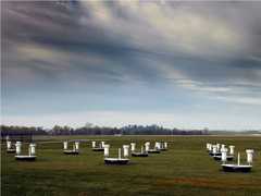
The Water vapor and Aerosol LIdar (WALI) is a mobile, ground-based Raman lidar developed at the Laboratoire des Sciences du Climat et de l’Environnement (LSCE). It measures lidar backscatter to determine aerosol optical properties and water vapor mixing ratio profiles. WALI operates at 354.7 nm and has a temporal sampling of about 1 minute. It has a vertical resolution of about 30 meters and a field of view of about 2.3 mrad.

Instrument Details
- Lidar
- Earth Science > Spectral/engineering > Lidar > Lidar BackscatterEarth Science > Atmosphere > Atmospheric Water VaporEarth Science > Atmosphere > Atmospheric Water Vapor > Water Vapor Indicators > Water VaporEarth Science > Atmosphere > AerosolsEarth Science > Atmosphere > Atmospheric Water Vapor > Water Vapor Profiles > Water Vapor Mixing Ratio ProfilesEarth Science > Atmosphere > Aerosols > Aerosol Optical Depth/thicknessEarth Science > Atmosphere > Aerosols > Aerosol Backscatter
- Full Column Profile
- 1 min
- 30 m
- 845.2 THz
- https://doi.org/10.5194/amt-7-1629-2014
Currently unavailable
Patrick Chazette
LSCE
Currently unavailable
Unpublished
 Field Site Stationary 76 Campaigns · 175 Instruments |  Hydrological Cycle in Mediterranean Experiment 2012 The Mediterranean 1 Deployment · 3 Data Products
|