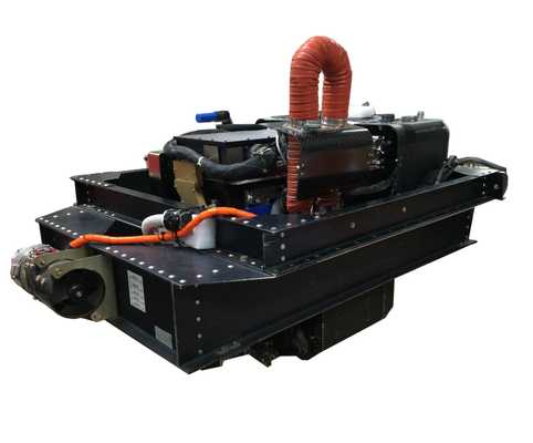
The Enhanced MODIS Airborne Simulator (eMAS) is an airborne cross-track scanning spectrometer operated by the Airborne Sensor Facility (ASF) at NASA Ames Research Center. eMAS captures high-resolution imagery of cloud and surface features, which can be used to develop and test algorithms for MODIS satellite observations. It operates across 38 spectral channels spanning 0.445 to 14.1 µm and has a scan rate of 6.25 Hz. eMAS provides a spatial resolution of 50 meters and a swath width of 37.25 kilometers at an altitude of 20 kilometers.


Instrument Details
- Spectrometer/Radiometer
- Earth Science > Spectral/engineering > Visible Wavelengths > Visible ImageryEarth Science > Spectral/engineering > Infrared Wavelengths > Infrared ImageryEarth Science > Spectral/engineering > Visible Wavelengths > Visible RadianceEarth Science > Spectral/engineering > Infrared Wavelengths > Infrared Radiance
- Lower Stratosphere, Troposphere
- 6.25 Hz
- 50 m
- 21-674 THz
- https://asapdata.arc.nasa.gov/emas/data/configs/eMAS_Solar_Reflectance_Band_Calibration_for_SEAC4RS.pdf
Kerry G. Meyer, James D. Jacobson Jr., Thomas Ellis, Steve Platnick
Steve Platnick
Daedalus Enterprises, Inc., Berkeley Camera Engineering, USU Space Dynamics Laboratory, and Ames Research Center
Earth Science Technology Office (ESTO)


