Overview
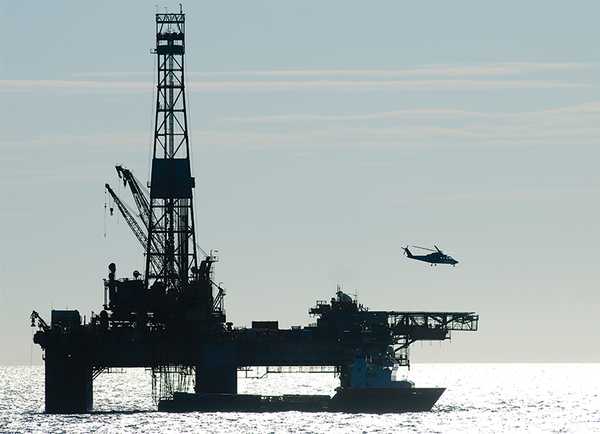
Permanent water sites are locations where one or more instruments are continuously operated. These instruments remain at the same site and do not change locations. Examples include moored buoy platforms, stream gauge platforms, and oil drilling towers.
Online information
Related Campaigns & Instruments
Review the instruments operated on this platform for each of these field campaigns
Slide 1 of 4

Hydrological Cycle in Mediterranean Experiment
2012
The Mediterranean
view all deployment dates
1 Deployment
· 3 Data Products| 2012-09-05 | 2012-11-06 |
Conductivity, Temperature, and Depth (CTD) sensors are in situ instruments that measure water depth, pressure, salinity, temperature, and density in the ocean. CTD sensors can be deployed on various water-based platforms, including autonomous underwater vehicles (AUVs), buoys, gliders, and research vessels. When mounted on a vessel, CTD sensors are typically attached to a rosette and lowered to the seafloor to record water properties. These sensors typically sample at 30 Hz and can provide accurate measurements at specific water depths, tailored to the researcher's needs.
Earth Science > Oceans > Ocean Pressure > Water Pressure
Earth Science > Oceans > Bathymetry/seafloor Topography > Water Depth
Earth Science > Oceans > Salinity/density > Conductivity
Earth Science > Oceans > Salinity/density > Density
Earth Science > Oceans > Salinity/density > Salinity
Earth Science > Oceans > Ocean Temperature > Water Temperature
Earth Science > Oceans > Salinity/density
Generic-Atmospheric State (Gen-AtmsState) refers to non-specific instruments on a platform that measure atmospheric state parameters. These are typically in situ sensors that measure temperature, pressure, humidity, and wind speed and direction. Types of atmospheric state instruments include thermometers, hygrometers, barometers, and anemometers.
Earth Science > Atmosphere > Atmospheric Water Vapor
Earth Science > Atmosphere > Atmospheric Pressure
Earth Science > Atmosphere > Atmospheric Water Vapor > Water Vapor Indicators > Humidity
Earth Science > Atmosphere > Atmospheric Temperature > Surface Temperature > Air Temperature
Earth Science > Atmosphere > Atmospheric Winds > Upper Level Winds > Wind Direction
Earth Science > Atmosphere > Atmospheric Winds > Upper Level Winds > Wind Speed
Earth Science > Atmosphere > Atmospheric Pressure > Atmospheric Pressure Measurements
Earth Science > Atmosphere > Atmospheric Winds > Surface Winds > Wind Direction
Earth Science > Atmosphere > Atmospheric Temperature
Earth Science > Atmosphere > Atmospheric Winds > Surface Winds > Wind Speed
Earth Science > Atmosphere > Atmospheric Winds

Impacts of Climate on the Eco-Systems and Chemistry of the Arctic Pacific Environment
2010—2011
Beaufort Sea, Chukchi Sea
view all deployment dates
2 Deployments
· 0 Data Products| 2011-06-25 | 2011-07-29 |
| 2010-06-15 | 2010-07-21 |
Conductivity, Temperature, and Depth (CTD) sensors are in situ instruments that measure water depth, pressure, salinity, temperature, and density in the ocean. CTD sensors can be deployed on various water-based platforms, including autonomous underwater vehicles (AUVs), buoys, gliders, and research vessels. When mounted on a vessel, CTD sensors are typically attached to a rosette and lowered to the seafloor to record water properties. These sensors typically sample at 30 Hz and can provide accurate measurements at specific water depths, tailored to the researcher's needs.
Earth Science > Oceans > Ocean Pressure > Water Pressure
Earth Science > Oceans > Bathymetry/seafloor Topography > Water Depth
Earth Science > Oceans > Salinity/density > Conductivity
Earth Science > Oceans > Salinity/density > Density
Earth Science > Oceans > Salinity/density > Salinity
Earth Science > Oceans > Ocean Temperature > Water Temperature
Earth Science > Oceans > Salinity/density

Ship-Aircraft Bio-Optical Research Experiment
2014
NW Atlantic Ocean
view all deployment dates
1 Deployment
· 0 Data Products| 2014-07-17 | 2014-08-07 |
The Sea-Viewing Wide Field-of-View Sensor (SeaWiFS) Photometer Revision for Incident Surface Measurements (SeaPRISM) is a surface-based photometer that supports the marine component of the AERONET network, AERONET-Ocean Color (AERONET-OC). It is a CIMEL Electronique automated sun photometer modified to measure sky- and sea-radiance. These measurements can be used to determine chlorophyll-ɑ concentration or ocean color. SeaPRISM operates across the 412 to 1020 nm spectral range and has a data acquisition rate of 1 Hz.
Earth Science > Atmosphere > Atmospheric Radiation > Solar Irradiance
Earth Science > Oceans > Ocean Optics > Radiance
Earth Science > Atmosphere > Atmospheric Radiation
Earth Science > Oceans > Ocean Optics > Ocean Color
Earth Science > Oceans > Ocean Optics

Chesapeake Lighthouse and Aircraft Measurements for Satellites
2001
Chesapeake Bay, Atlantic Ocean
view all deployment dates
1 Deployment
· 5 Data Products| 2001-06-29 | 2001-08-02 |
Generic-Atmospheric State (Gen-AtmsState) refers to non-specific instruments on a platform that measure atmospheric state parameters. These are typically in situ sensors that measure temperature, pressure, humidity, and wind speed and direction. Types of atmospheric state instruments include thermometers, hygrometers, barometers, and anemometers.
Earth Science > Atmosphere > Atmospheric Water Vapor
Earth Science > Atmosphere > Atmospheric Pressure
Earth Science > Atmosphere > Atmospheric Water Vapor > Water Vapor Indicators > Humidity
Earth Science > Atmosphere > Atmospheric Temperature > Surface Temperature > Air Temperature
Earth Science > Atmosphere > Atmospheric Winds > Upper Level Winds > Wind Direction
Earth Science > Atmosphere > Atmospheric Winds > Upper Level Winds > Wind Speed
Earth Science > Atmosphere > Atmospheric Pressure > Atmospheric Pressure Measurements
Earth Science > Atmosphere > Atmospheric Winds > Surface Winds > Wind Direction
Earth Science > Atmosphere > Atmospheric Temperature
Earth Science > Atmosphere > Atmospheric Winds > Surface Winds > Wind Speed
Earth Science > Atmosphere > Atmospheric Winds
Generic-Chemistry Related Sensors (Gen-Chemistry) refers to non-specific instruments on a platform used for atmospheric chemistry measurements. These are typically in situ analyzers that measure chemical compounds such as trace gases, halocarbons, volatile organic compounds, nitrates, aerosols, and other chemical species. Measurements can include mixing ratios, composition, particle size, optical properties, and particle size distribution.
Earth Science > Atmosphere > Atmospheric Chemistry > Trace Gases/trace Species
Earth Science > Atmosphere > Atmospheric Chemistry
Earth Science > Atmosphere > Air Quality > Volatile Organic Compounds
Earth Science > Atmosphere > Aerosols
Earth Science > Atmosphere > Aerosols > Aerosol Particle Properties
Earth Science > Atmosphere > Atmospheric Chemistry > Halocarbons And Halogens
Earth Science > Atmosphere > Air Quality
Earth Science > Atmosphere > Atmospheric Chemistry > Carbon And Hydrocarbon Compounds
Nephelometers are in situ optical sensors that can be airborne or ground-based. They measure the total scattering and backscattering of atmospheric aerosol particles. Nephelometers operate at three wavelengths: 450 nm, 550 nm, and 700 nm, with a typical time resolution of 1 Hz.
Earth Science > Atmosphere > Aerosols > Aerosol Forward Scatter
Earth Science > Atmosphere > Aerosols > Aerosol Backscatter
Earth Science > Atmosphere > Aerosols
Earth Science > Atmosphere > Aerosols > Aerosol Extinction
The Micropulse Lidar (MPL) is a ground-based lidar system used for cloud detection. It measures lidar backscatter at 532 nm to retrieve cloud properties, including cloud top and base heights. It can also detect aerosols. MPL has a vertical resolution of 15 m and a maximum range of 18 km. MPL can operate autonomously and typically provides 10-second averaged data.
Earth Science > Spectral/engineering > Lidar > Lidar Backscatter
Earth Science > Atmosphere > Clouds
Earth Science > Atmosphere > Clouds > Cloud Properties > Cloud Top Height
Earth Science > Spectral/engineering > Lidar
Earth Science > Atmosphere > Clouds > Cloud Properties
Earth Science > Atmosphere > Clouds > Cloud Properties > Cloud Base Height
Earth Science > Spectral/engineering > Lidar > Lidar Depolarization Ratio
Sunphotometers are passive optical sensors that measure the amount of sunlight. They are pointed directly at the sun to measure direct sunlight, not sunlight scattered by aerosols. These measurements can be used to determine aerosol optical depth by applying Beer’s Law. Sunphotometers have been deployed on aircraft, research vessels, and field sites for aerosol research and monitoring.
Earth Science > Atmosphere > Aerosols
Earth Science > Atmosphere > Atmospheric Radiation > Sunshine
Earth Science > Atmosphere > Atmospheric Radiation
Earth Science > Atmosphere > Aerosols > Aerosol Optical Depth/thickness
A pyrheliometer is a ground-based passive radiation sensor used to measure direct-beam solar irradiance. It uses a thermopile that converts heat from sunlight into an electrical signal to determine solar radiation. Pyrheliometers measure solar radiation in the 200-4000 nm wavelength range.
Earth Science > Atmosphere > Atmospheric Radiation > Solar Irradiance
Earth Science > Atmosphere > Atmospheric Radiation > Solar Radiation
Earth Science > Atmosphere > Atmospheric Radiation
Condensation Particle Counters (CPCs) are in situ sensors that measure aerosol particle concentrations. CPCs determine aerosol concentrations by condensing a fluid onto particles, causing them to grow to sizes detectable by optical scattering. Typically, CPCs detect particles from 7 nm to 3 μm, measure concentrations up to 100,000 particles per cubic centimeter, and provide readings every second. CPCs are manufactured by TSI Incorporated and can be used on airborne, shipborne, and ground-based platforms.
Earth Science > Atmosphere > Aerosols
Earth Science > Atmosphere > Aerosols > Aerosol Particle Properties
The Multifilter Rotating Shadowband Radiometer (MFRSR) is a ground-based passive radiometer that measures the global and diffuse components of solar irradiance. It measures solar irradiance across six narrowband channels and one broadband channel. The nominal wavelengths of the narrowband channels are 415, 500, 615, 673, 870, and 940 nm. MFRSR typically samples every 20 seconds and takes measurements at four shadowband positions: nadir, first side-band, sun-blocked, and second side-band. MFRSR is deployed at several of the Department of Energy’s Atmospheric Radiation Measurement (ARM) User Facility sites.
Earth Science > Atmosphere > Atmospheric Radiation
Earth Science > Atmosphere > Atmospheric Radiation > Solar Irradiance > Shortwave Downward Irradiance
Earth Science > Atmosphere > Atmospheric Radiation > Solar Irradiance
A pyrgeometer is a ground-based or airborne passive radiation sensor that measures downward and upward longwave radiation in the 4-50 μm spectral range. It uses a thermopile sensor to detect changes in resistance or voltage, which are then used to determine longwave radiation. These measurements can be used to calculate the infrared radiation flux. Pyrgeometers are typically used for climatological, meteorological, and agricultural applications.
Earth Science > Atmosphere > Atmospheric Radiation
Earth Science > Atmosphere > Atmospheric Radiation > Outgoing Longwave Radiation
Earth Science > Atmosphere > Atmospheric Radiation > Longwave Radiation
A pyranometer is a ground-based or airborne radiation sensor that measures solar irradiance over a hemispherical field of view. It detects the amount of solar energy reaching the surface, capturing both direct and diffuse sunlight. Pyranometers operate across a spectral range of 280-3000 nm. They are most commonly used for solar monitoring, climate research, weather forecasting, agriculture, and energy management.
Earth Science > Atmosphere > Atmospheric Radiation > Solar Irradiance
Earth Science > Atmosphere > Atmospheric Radiation > Solar Radiation
Earth Science > Atmosphere > Atmospheric Radiation
Filter data products from this platform by specific campaigns, instruments, or formats.
Campaigns
CAMPAIGNS▼
Instruments
INSTRUMENTS▼
Formats
FORMATS▼
