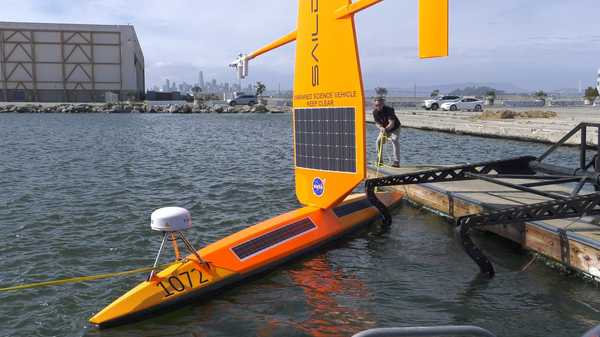
Overview
Saildrones are uncrewed surface vehicles (USVs) that act as autonomous meteorological and oceanographic sensors. They use wind-powered propulsion and solar energy for long-distance data collection and can operate for up to a year with minimal maintenance. They can reach speeds of 3-5 knots and travel over 750,000 nautical miles while carrying scientific instruments and cameras.
Online information
Related Campaigns & Instruments
Review the instruments operated on this platform for each of these field campaigns

Sub-Mesoscale Ocean Dynamics Experiment
| 2023-04-03 | 2023-05-02 |
| 2022-10-06 | 2022-11-07 |
| 2021-10-17 | 2021-11-09 |
Salinity Processes in the Upper Ocean Regional Study
| 2012-08-16 | 2013-10-13 |
| 2016-08-13 | 2017-11-17 |
Atlantic Tradewind Ocean-Atmosphere Mesoscale Interaction Campaign
| 2020-01-07 | 2020-02-13 |
Atlantic Tradewind Ocean-Atmosphere Mesoscale Interaction Campaign
| 2020-01-07 | 2020-02-13 |
Filter data products from this platform by specific campaigns, instruments, or formats.
