Overview
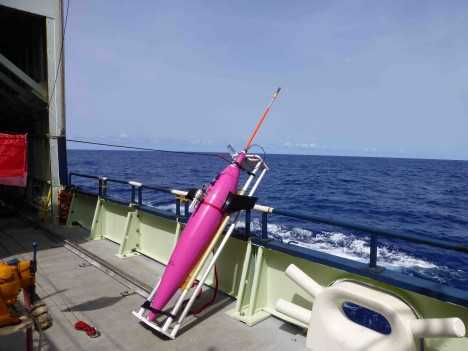
The SeaGlider is an autonomous underwater vehicle (AUV) operated by the Applied Physics Laboratory and the School of Oceanography at the University of Washington. It gathers measurements similar to those collected by research vessels or moored water platforms, either at a fixed location or along a transect, with a maximum depth of 1000 meters and a range of 4600 kilometers. Its design and ability to move smoothly through the water make it an excellent platform for chemical, physical, and biological oceanographic research.
Related Campaigns & Instruments
Review the instruments operated on this platform for each of these field campaigns

EXport Processes in the Ocean from RemoTe Sensing
| 2018-07-21 | 2018-09-13 |
| 2021-03-25 | 2021-06-01 |

Sub-Mesoscale Ocean Dynamics Experiment
| 2023-04-03 | 2023-05-02 |
| 2022-10-06 | 2022-11-07 |
| 2021-10-17 | 2021-11-09 |
Salinity Processes in the Upper Ocean Regional Study
| 2012-08-16 | 2013-10-13 |
| 2016-08-13 | 2017-11-17 |

EXport Processes in the Ocean from RemoTe Sensing
| 2018-07-21 | 2018-09-13 |
| 2021-03-25 | 2021-06-01 |
Filter data products from this platform by specific campaigns, instruments, or formats.
